- 50th HS Reunion - Part 1 - Reno to Pittsburgh
- Yellowstone National Park, Part 2
- Devils Tower National Monument
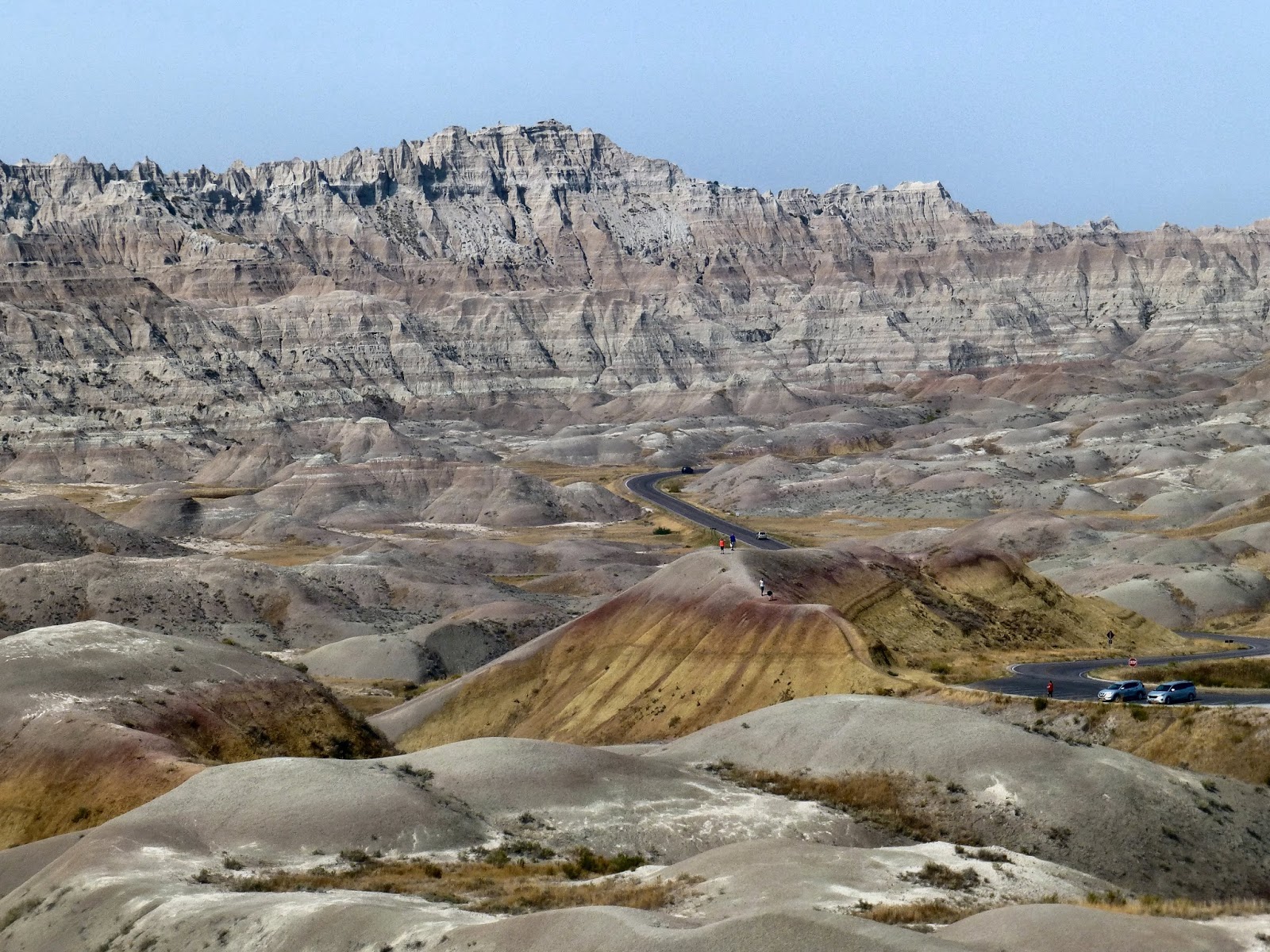
- Badlands National Park
- 50th HS Reunion - Part 2 - Pittsburgh to Reno
- Shenandoah National Park
- Blue Ridge Parkway
- Great Smoky Mountains National Park
- Great Sand Dunes National Park
- Black Canyon of the Gunnison National Park
- Arches National Park Encore
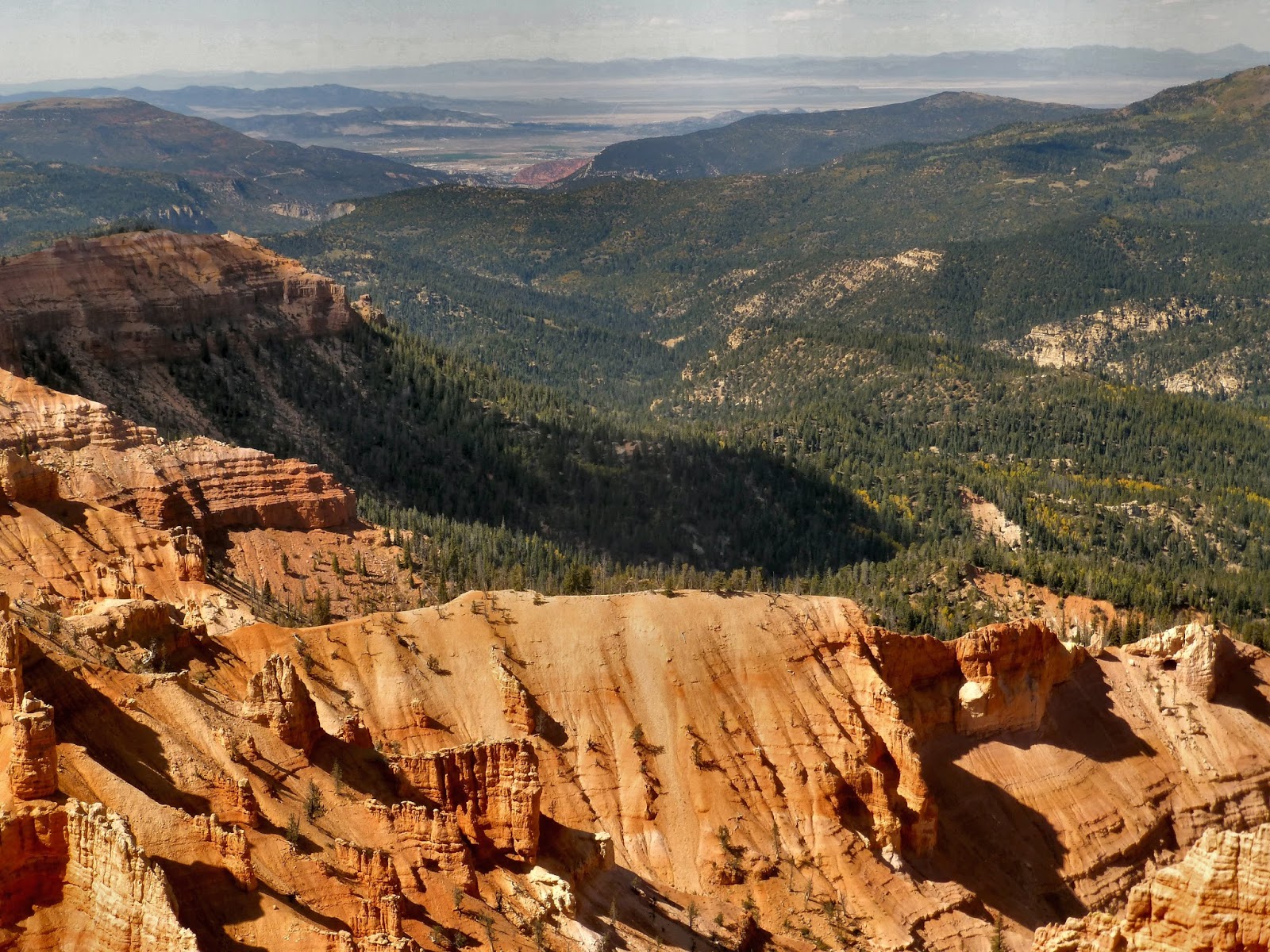
- Natural Bridges and Cedar Breaks National Monuments
- 50th HS Reunion - Epilogue

- - - - -
If you came here first, you are at the end of this particular journey. You can click HERE to go to the beginning. Or you can use the sidebar or the outline above to select the part you want to see.
- - - - -
We
were very fortunate on this trip and things went exceptionally well. We
quickly handled the few problems we encountered and we kept to our
planned schedule almost without any difficulties. We even had some
pleasant surprises.
Our trip lasted 27 days and 26 nights and, according to the odometer, we drove just slightly over 8,000 miles.
We were in 23 different states and slept in 12 of them. Well, to be completely honest about it, we were in Maryland for less than 5 minutes as we crossed from Pennsylvania into West Virginia. We were in Arizona for 30 minutes as we crossed from Utah to Nevada, and we were in Kentucky for 90 minutes as we crossed from Tennessee into Illinois. Of course, we also spent six weeks crossing Kansas so it sort of balances out.
The car computer determined that we averaged 50 mph over the course of this trip (so much for 80 mph speed limits), and that works out to 160 hours in the car (while it was moving--construction delays in Illinois probably added a few more hours).
We visited 7 National Parks, 4 National Monuments, and one National Parkway as well as Interstate 70 in Utah which should at least be a National Parkway. We also visited two historic houses and, of course, we went to our 50th High School Reunion.
I kept a daily analog journal of this trip (pen and paper) and I'm going to continue this practice. I found a number of times where my certain memory didn't quite match what I wrote at the time (maybe Kansas didn't take six weeks after all).
I bought a quality dash cam but it's still only a dash cam. You can judge for yourself if the posted recordings were worth saving.
The recordings of most animals were a particular disappointment. We passed roadside pronghorn and turkeys and birds swooping in front of us, as well as cattle crossing the road ahead, but none of that recorded well enough to even recognize.
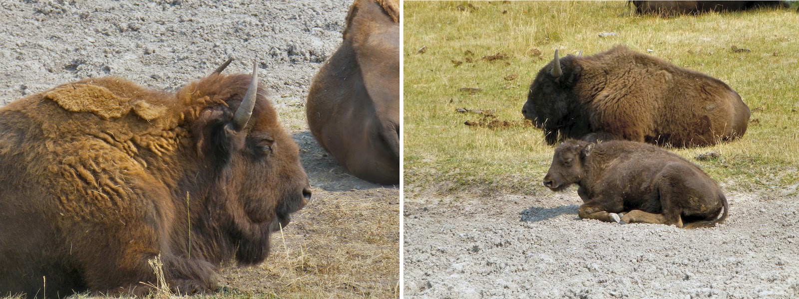
Even the bison recording wasn't what I had hoped for. We were a lot closer to the action than the wide-angle lens shows.
(Also, the time stamp, after it was set, gives the time as PDT no matter which of the four time zones we were in.)
Our trip lasted 27 days and 26 nights and, according to the odometer, we drove just slightly over 8,000 miles.
We were in 23 different states and slept in 12 of them. Well, to be completely honest about it, we were in Maryland for less than 5 minutes as we crossed from Pennsylvania into West Virginia. We were in Arizona for 30 minutes as we crossed from Utah to Nevada, and we were in Kentucky for 90 minutes as we crossed from Tennessee into Illinois. Of course, we also spent six weeks crossing Kansas so it sort of balances out.
The car computer determined that we averaged 50 mph over the course of this trip (so much for 80 mph speed limits), and that works out to 160 hours in the car (while it was moving--construction delays in Illinois probably added a few more hours).
We visited 7 National Parks, 4 National Monuments, and one National Parkway as well as Interstate 70 in Utah which should at least be a National Parkway. We also visited two historic houses and, of course, we went to our 50th High School Reunion.
I kept a daily analog journal of this trip (pen and paper) and I'm going to continue this practice. I found a number of times where my certain memory didn't quite match what I wrote at the time (maybe Kansas didn't take six weeks after all).
I bought a quality dash cam but it's still only a dash cam. You can judge for yourself if the posted recordings were worth saving.
The recordings of most animals were a particular disappointment. We passed roadside pronghorn and turkeys and birds swooping in front of us, as well as cattle crossing the road ahead, but none of that recorded well enough to even recognize.
Even the bison recording wasn't what I had hoped for. We were a lot closer to the action than the wide-angle lens shows.
(Also, the time stamp, after it was set, gives the time as PDT no matter which of the four time zones we were in.)
- - - - -
An
interesting aspect of our travels is that we are almost always going to
places for the first time. Later, we always talk about what we would do
it differently if we could do it all over again and we have missed
things that we would have included had we only known.
Virginia is a good example. With its historical spots from both the Revolution and the Civil War, we could have easily spent a month just there and I would have been happy to drive the Blue Ridge Parkway for several months. I didn't realize how close Monticello and Poplar Forest were to Shenandoah and that hurts.
Of course, on this trip we returned to Arches and the second visit wasn't exactly an improvement over the first one, so, there's that. But, still, you just can't make your first visit twice.
Our original travel plans had us returning through the south but the hurricanes convinced us to change plans and we ended up returning through the mid-west. So, we are seriously considering another cross-country trip, this time across the southern United States and up through Virginia. But, maybe we'll come to our senses first.
- - - - -
To see some additional photos from this trip, go to: Pictures from a Journey